


Best 11 Beginner Backpacking Trips in California
There are many options for the first excursion; some recommendations for backpacking trips in California are below. I don't think you'd regret doing any of them.
A word of caution: I recommend some day hikes without a clearly defined trail because route finding can lend a sense of adventure! Since there isn't a clearly defined trail, it's easy to get lost, so I'd try to read more online about the hike and ensure I feel confident.
In the titles, "miles" and "ft" refer to, respectively, the number of miles and elevation change to get to the campsite (not there and back). Additionally, the order of the trails is ascending driving distance from San Francisco, with drive time listed as "hr drive."
Dipsea and Steep Ravine Trail (2.7 miles, +1475/-120 ft, 1 hr drive)
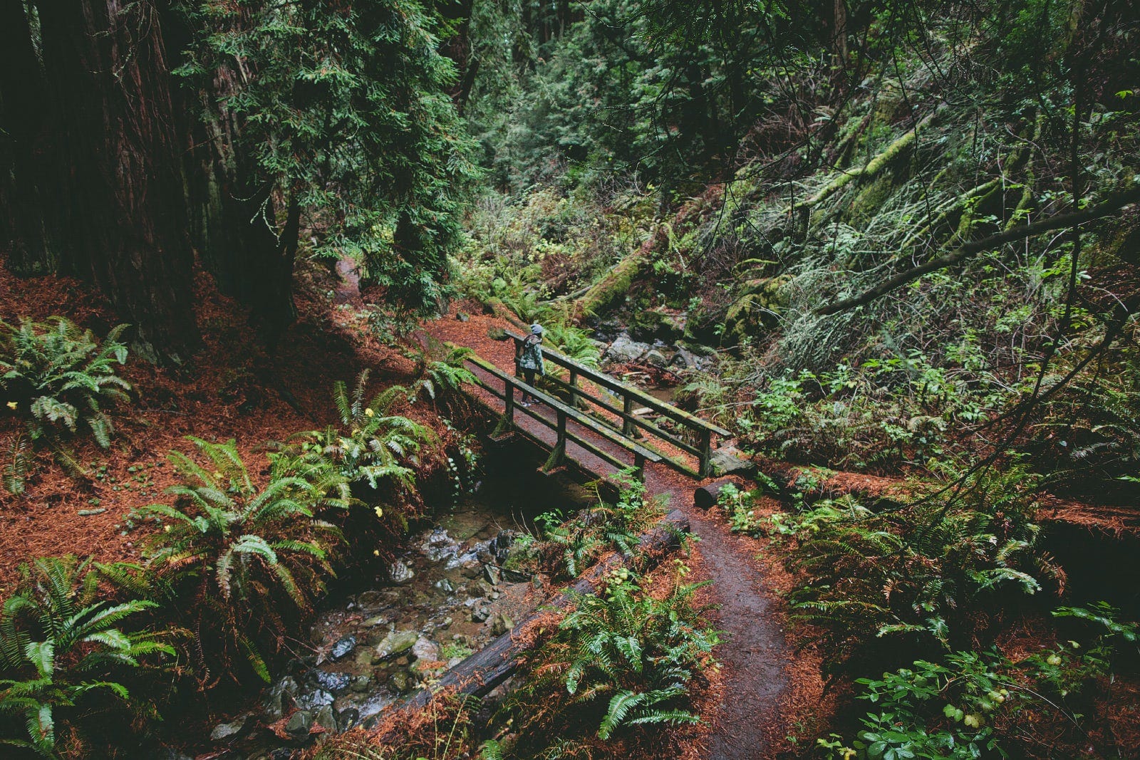
This visually dynamic loop is nearby and has campsites with bathrooms and fire pits. It’s hard and can be hot, so don’t rush it. Since the trail is first come, first served, consider visiting on a weekday.
Season: Spring / Fall / Winter
Trailhead: Dipsea Trail Head Parking
Permit: Pantoll Campground is first come, first served.
Trail Map: Red "Dipsea and Steep Ravine Trail" here
Variations: On the way back, take the Matt Davis Trail down; blue here.
Wildcat Camp (6 miles, +1259/-1024 ft, 1 hr drive)

Close to San Francisco, it’s an easy hike with access to Alamere Falls, pictured above. It can be cold with the fog so bring enough layers. Also, check the tides schedule to know when there is beach access.
Season: Spring / Fall / Winter
Trailhead: Five Brooks Trailhead
Permit: Loop "Wildcat" in Point Reyes (reserve here)
Trail Map: Red "Wildcat Camp Trail" here
Day Hikes: Visit Alamere Falls, purple trail here.
Sykes Hot Springs (6.7 miles, +1960/-1268 ft, 2½ hr drive)
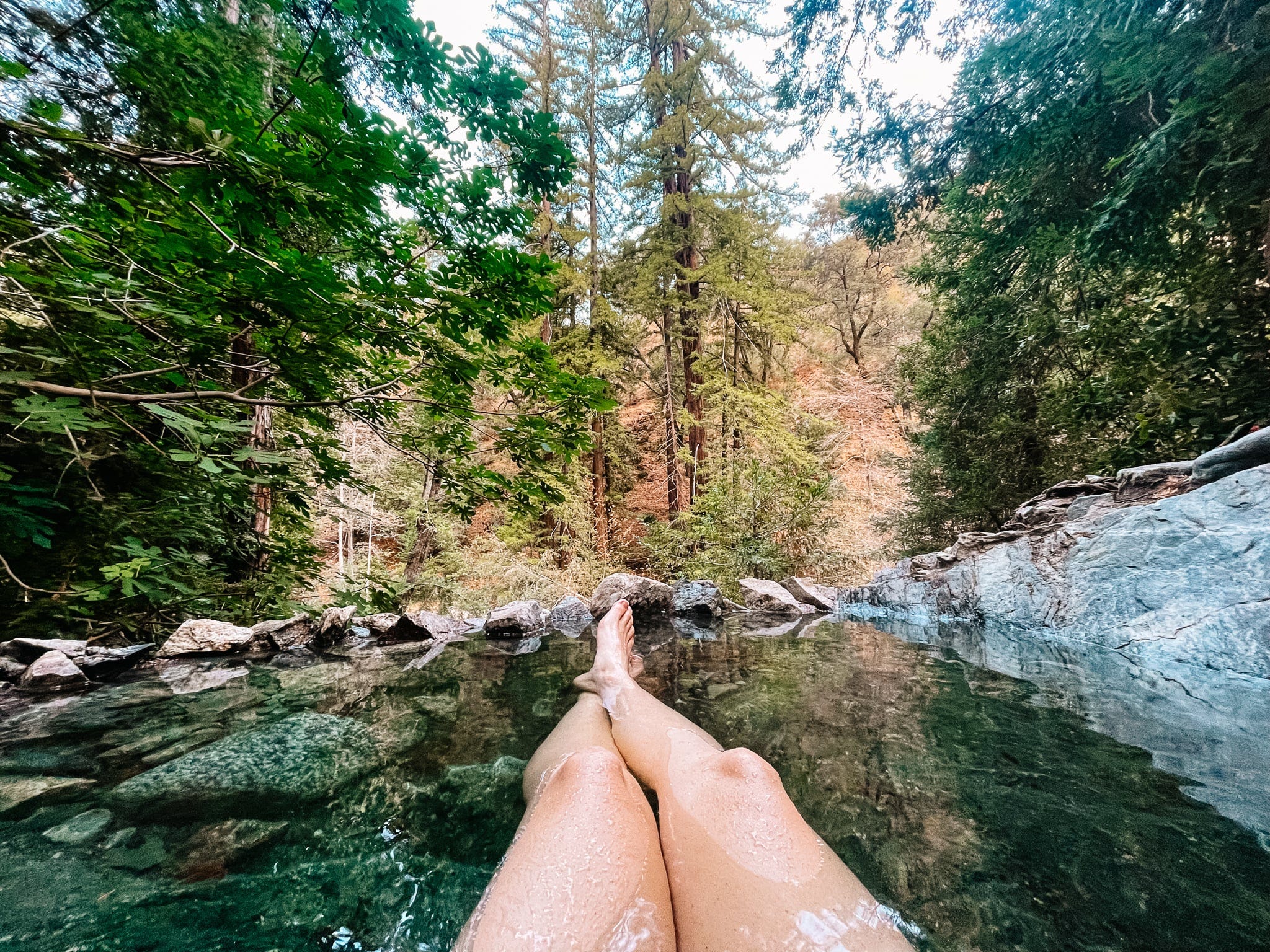
If you love hot springs and a challenge, this trail will deliver. The hot springs can be overcrowded so try hitting them in the morning or a weekday for more seclusion.
Season: Spring / Fall / Winter
Trailhead: Pine Ridge Trail
Permit: No permit required
Trail Map: Red "Pine Ridge Trail" here
Day Hikes: Dip in at Sykes Hot Springs, purple here. Spend an extra night to accommodate the day trip and ask around for the best tubbing spots.
Lake Aloha (5.8 mi, +1116/-454 ft, 3 hr drive)
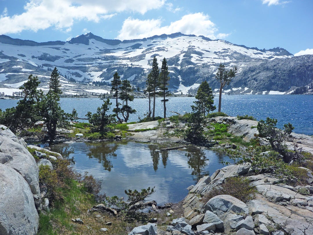
If you love alpine lakes, this is the trail for you. A string of lakes line the route, and rocky peaks tower over. It's one of the most popular areas in Desolation in the summer with a water taxi on Tamarack Lake.
Season: Summer / Fall
Trailhead: Echo Lake Trailhead
Permit: "33 Aloha" in Desolation (reserve here)
Trail Map: Red "Lake Aloha Trail" here
Day Hikes
Lake of the Woods & Ralston Peak; purple trail here. Ralston Peak provides a view of the surrounding area and is worth the hike up.
Lake of the Woods & Ropi Lake; orange trail here.
Middle Velma Lake (5 miles, +1843/-763 ft, 3½ hr drive)
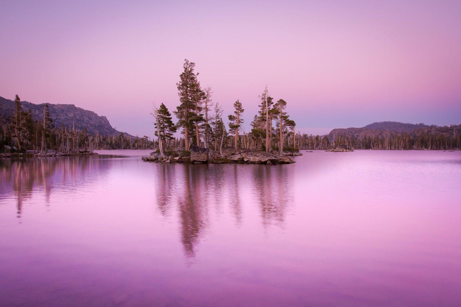
The Velmas are seemingly never-ending, as great swim holes with little islands. It's my favorite spot in the Lake Tahoe area. It has the best place for watching sunsets at Maggies Peak's Saddle overlooking Eagle Lake.
Season: Summer / Fall
Trailhead: Bayview Trailhead
Permit: "16 Middle Velma" in Desolation (reserve here)
Trail Map: Red "Middle Velma Trail" here
Day Hikes: Dick's Lake; purple trail here
Variations: If you have two cars or are open to hitchhike, start the hike from Eagle Lakes Trailhead and end it at Bayview Trailhead. Orange on here is the Eagle Lakes Trailhead alternative route. The trailheads are only 5 minutes by car away from each other, but walking on the highway is impossible.
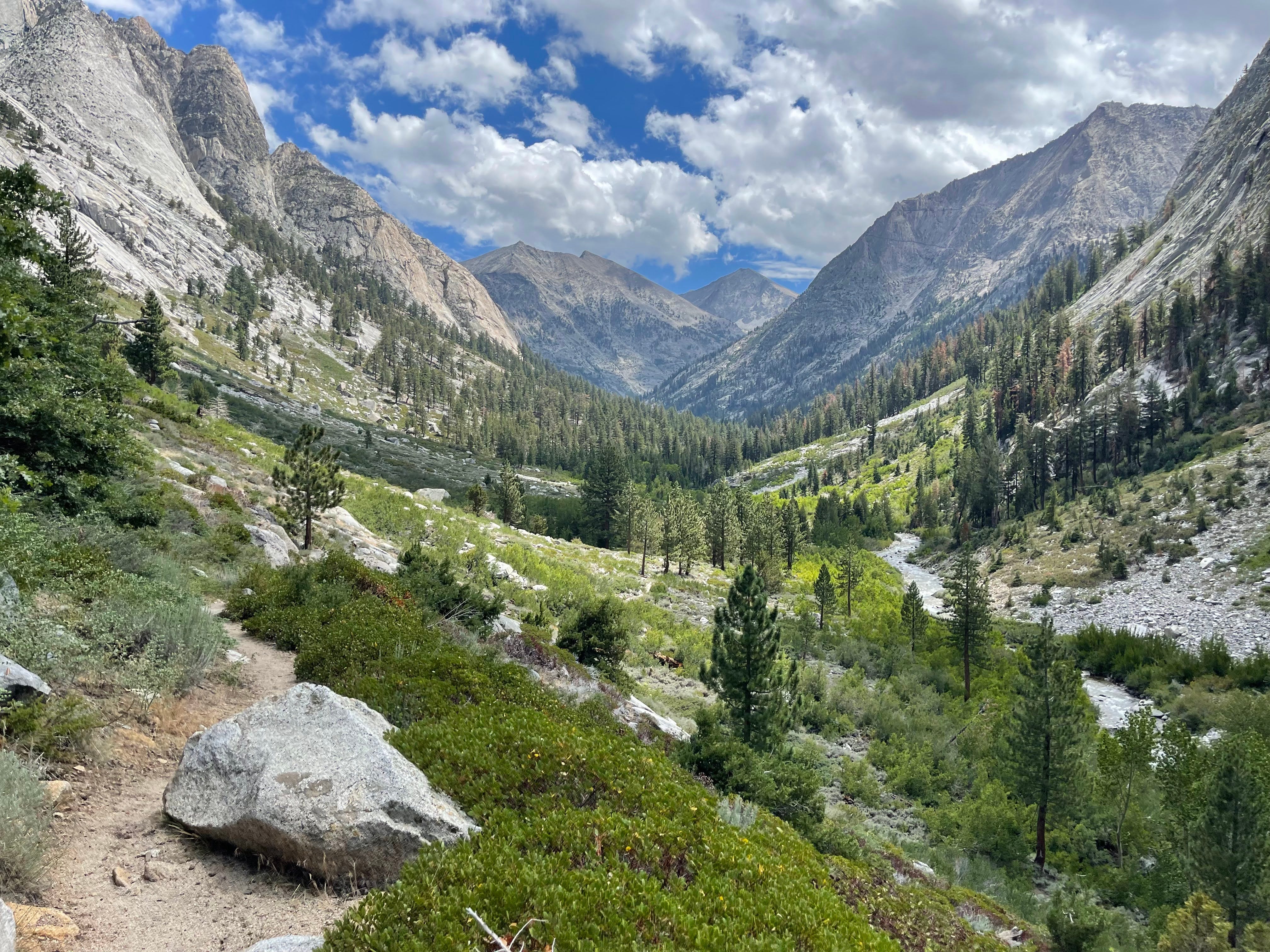
Lily Lake (4.9 miles, +1200/-509 ft, 3½ hr drive)
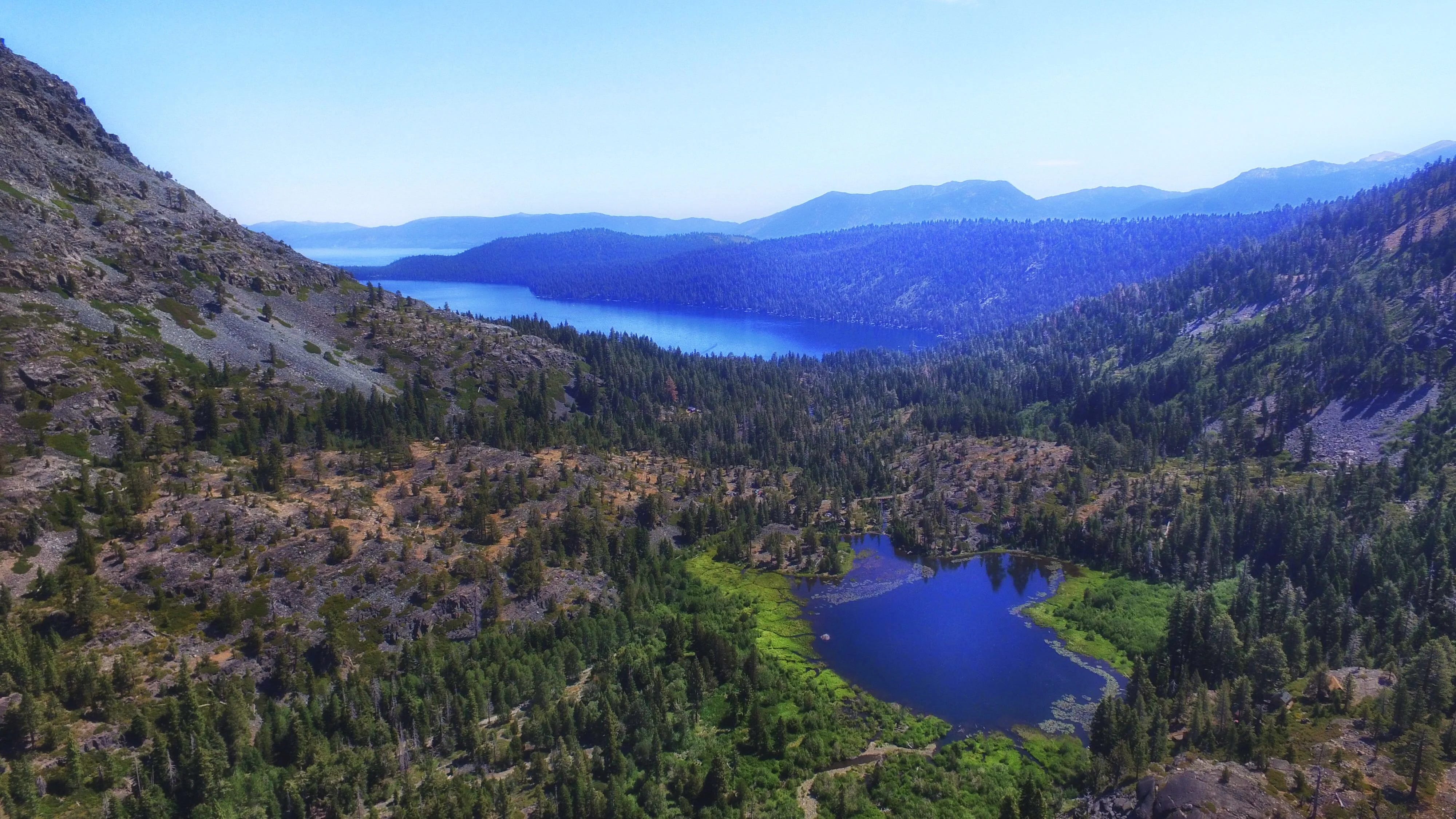
Planning is easy: permits are free and unlimited. The trail passes by lakes and winds through forest and granite for spectacular site seeing. It's a taste of the Sierras with half the driving distance and none of the permit headache.
Season: Spring / Fall
Trailhead: Crabtree Trailhead
Permit: Pick up a free permit at the ranger station (read more here)
Trail Map: Red "Lily Lake Trail" here
Day Hikes
Little Yosemite Valley (5.2 miles, +2431/-337 ft, 4 hr drive)
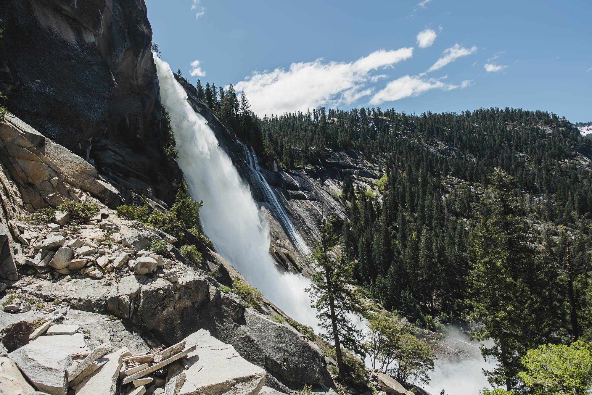
It’s the quintessential Yosemite hike and worth all the hype. Waterfalls and granite streak the scenery. One section has clouds of water droplets cooling you down, aptly called the “Mist Trail.” Then, there are the cables up to Half Dome to help you climb up and see all of Yosemite Valley.
Season: Summer / Fall
Trailhead: Happy Isles
Permit: "Happy Isles->Little Yosemite Valley (No Donohue Pass)" in Yosemite (reserve here)
Trail Map: Red "Little Yosemite Valley Trail" here
Day Hikes: The permit includes Half Dome, and I recommend spending an extra night to do it. Purple "Half Dome Trail" here.
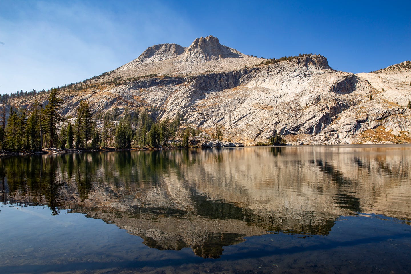
Ten Lakes (6.3 miles, +2472/-753 ft, 4½ hr drive)
It's a challenging hike offering all the Sierra greats: granite, lakes, peaks, and creeks.
Season: Summer / Fall
Trailhead: Ten Lakes Trailhead
Permit: "Ten Lakes" in Yosemite (reserve here)
Trail Map: Red "Ten Lakes Trail" here
May Lake (3.3 miles, +959/-161 ft, 4½ hr drive)
The trail is an easy trip with spectacular alpine views and a lake to boot. If you are still hungry for more, hike up Mount Hoffman for 360 Yosemite Valley views.
Season: Summer / Fall
Trailhead: May Lake Trailhead
Permit: "May Lake" in Yosemite (reserve here)
Trail Map: Red "May Lake Trail" here
Day Hikes: Mount Hoffman; purple here. It’s easy to get lost going up, so research the trail before leaving.
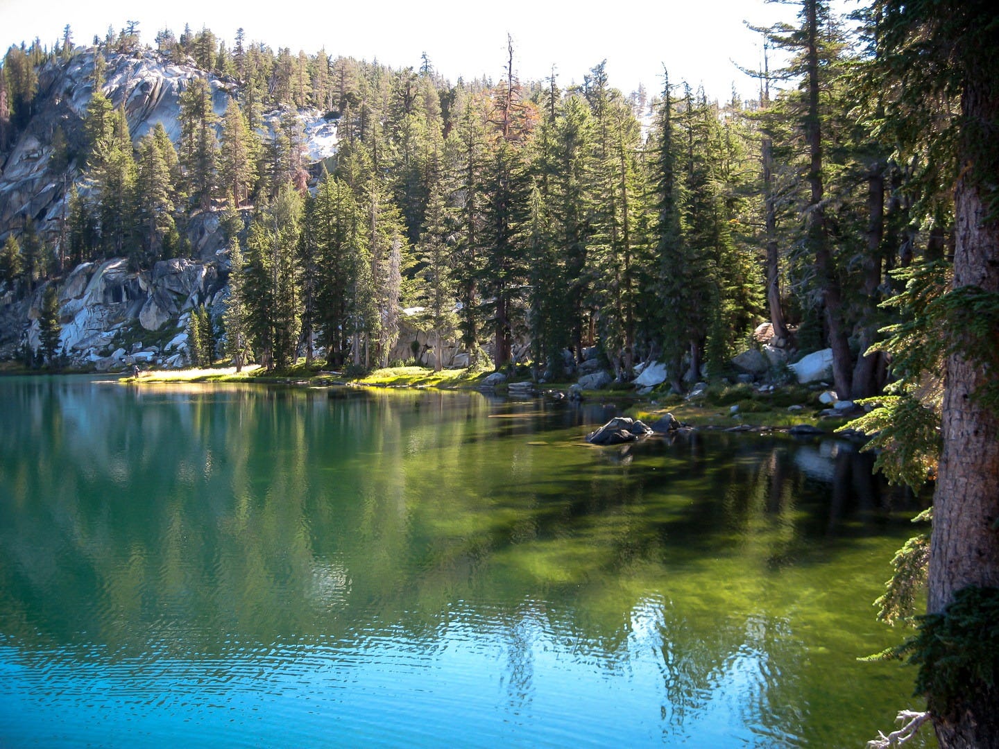
Duck Lake (4.9 miles, +1830/-437 ft, 5½ hr drive)

It's a fun and popular day hike in Mammoth, so you'll likely run into more than a few jolly folks. While the trail ends at Duck lake, you pass by so many other lakes en route, as well as creeks, rocky hillsides, sand, and lush greenery. While the most challenging sections are the start and the end, it's beautiful throughout.
Season: Summer / Fall
Trailhead: Duck Lake Pass Trailhead
Permit: "Duck Pass" in John Muir (reserve here)
Trail Map: Red "Duck Lake Trail" here
Day Hikes: Walk on over to Purple Lake for a dip. Purple "Purple Lake Hike" here.
Variations: On the way back, pass Emerald Lake, one of my favorite lakes in the Sierras. The orange trail here.
Ediza Lake (6.7 miles, +1564/-562 ft, 5½ hr drive*)
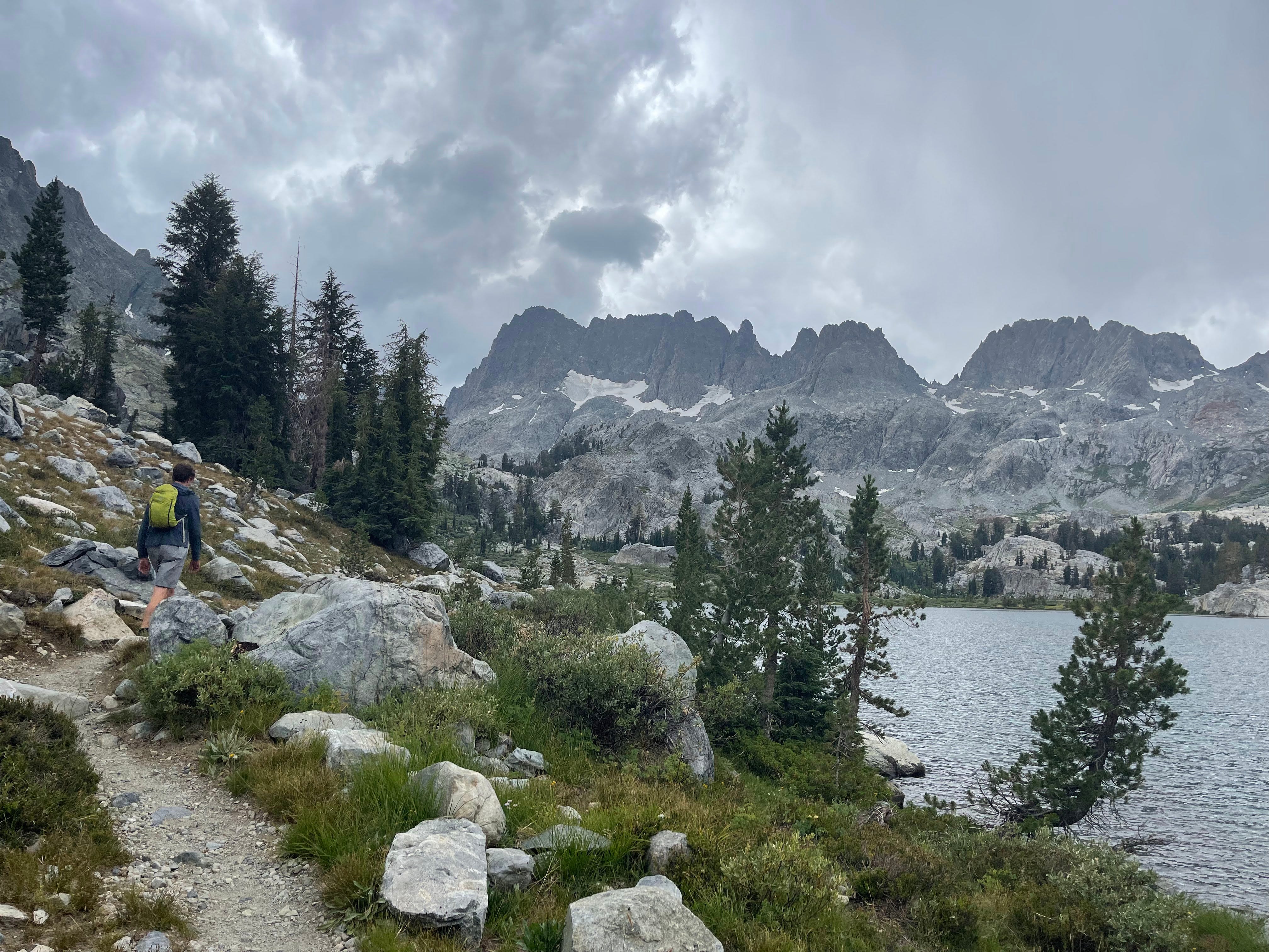
This is my favorite trail in California. At Ediza Lake, you sleep underneath the jagged Minaret pinnacles surrounded by water and delicate wildflowers. This magical trail won't disappoint.
Season: Summer / Fall
Trailhead: Agnew Meadows Trailhead (Caution: Requires taking the bus near the Mammoth Lodge, more information on the shuttle and where to park here.)
Permit: "Shadow Creek" in Ansel Adams (reserve here)
Trail Map: Red "Ediza Lake Trail" here
Day Hikes
Iceberg Lake - Visit the upper lake on the trail. See the orange "Iceberg Lake Hike" here.
Cecile Lake and Minaret Lake - This requires good route finding skills since there won't be a trail. It's lovely but make sure to turn around if it’s feeling uncomfortable. See the blue "Minaret Lake Hike" here.
Variations: Instead of going to Ediza Lake, go to Minaret Lake. The camping isn't as beautiful, but it's still one of the top places to camp in the Eastern Sierras and allows you to do the same day hikes. The permit is for "Minaret Lake" in Ansel Adams (reserve here); see the purple "Minaret Lake Trail" here.
Wow, saving this post!