
It's always necessary to have GPS or another mapping system on a trail (more here). However, sometimes, I'll get confused by my GPS, too tired to take out my phone, or just prefer to keep my eyes on the scenery. In those cases, knowing how to navigate tricky sections of a trail without needing to reference a map is helpful.
I got better at finding the trail by losing it many, many times and needing to find it again. The closest proxy I could think of was providing examples of navigating on a trail so that even if you are less experienced, you'll be more comfortable finding the trail and trusting your gut.
Find Trail Markers
Trail markers indicate that we are on the trail and help when we come to crossroads. Usually, particular trails, parks, terrains, and parts of the country use one type more than others. For example, in the Sierras, when climbing up a rocky peak you almost always find piles of rock. Usually before leaving on a backpacking trip, I research if there are particular ways the trail is known to be marked. In addition to that, sometimes previous hikers or backpackers will take pictures of tricky sections to navigate and I’ll make sure to have a copy of that information when I’m outside.
To get more familiar with trail markers, here are a couple of different kinds:
Cairns
Watch for piles of rocks stacked on each other; these are called cairns. Don’t knock them over! Cairns are used to indicate a hiker is still on the trail even if the trail isn't marked. If the cairn was hard to see, consider adding more rocks to it or building another cairn closer to the trail.


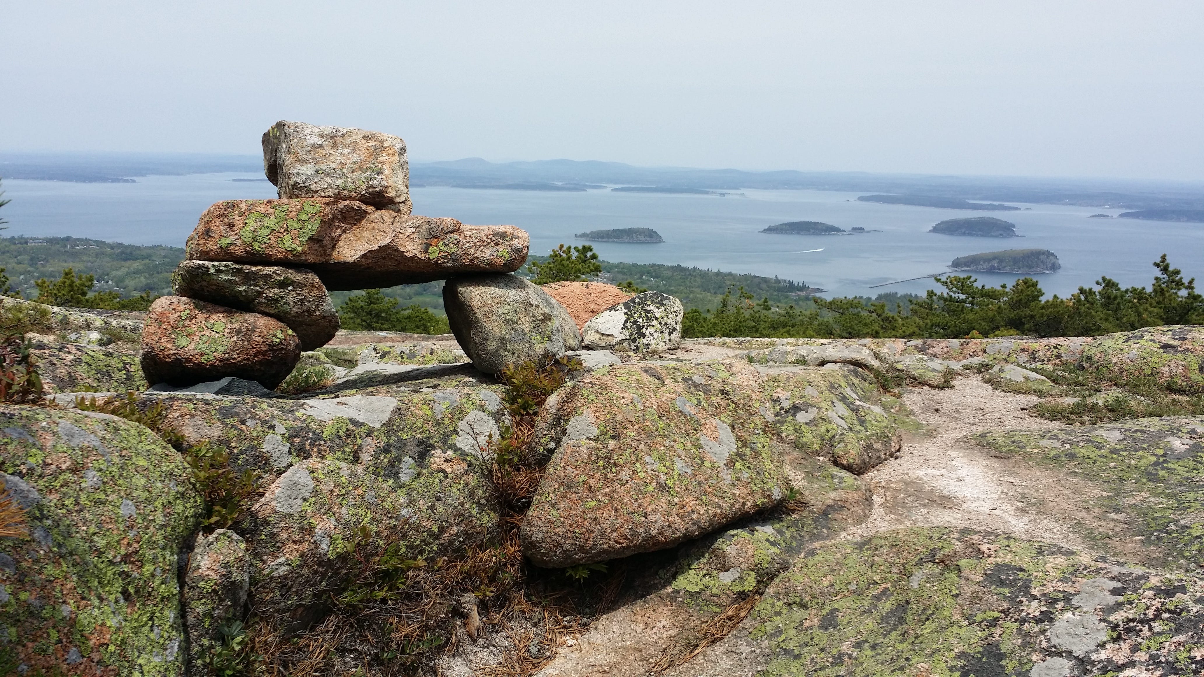

In addition, if a storm came in, instead of a cairn, there may be a pile of small rocks grouped together in a section where there aren’t naturally occurring rocks of those size. This is likely a broken cairn and is also an indication of being on trail.
Trail Blazes
Look for paint on trees or rocks. These are often on rocky hiking trails or areas with a lot of snow. Generally, trails either use blazes the whole way or don’t use them at all. When researching for this post, I learned particular trail blazes signify what to do like “right turn” or “go straight” (more here). I’ve never “read” trail blazes before so I wouldn’t recommend learning about it unless you’re interested.

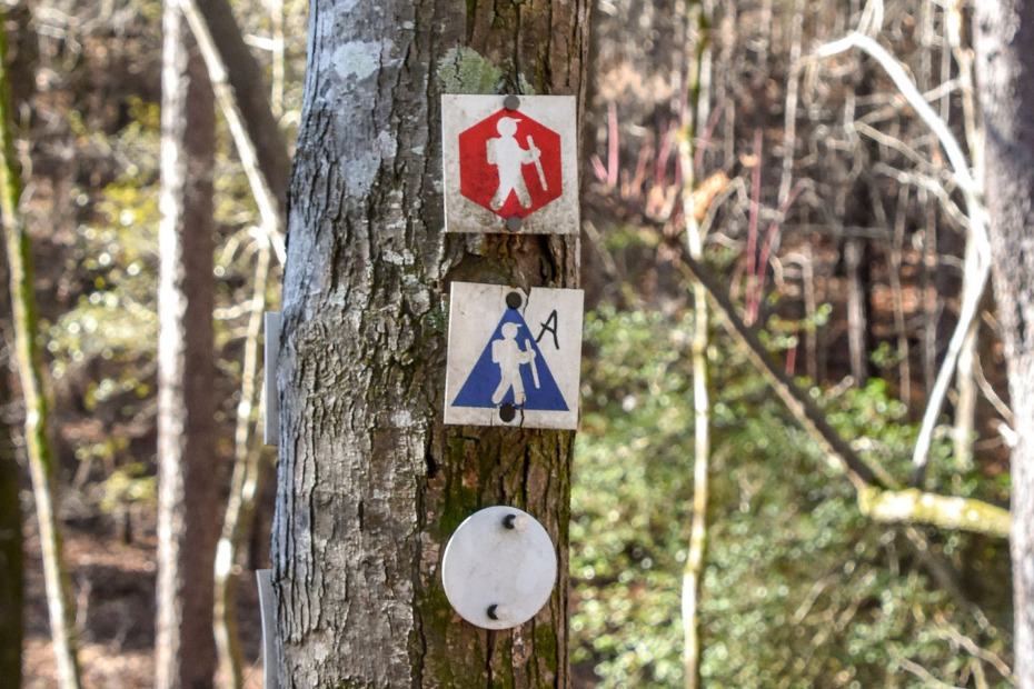
Affixed Markers
Sometimes colored plastic or trail symbols are attached to trees to mark the trail. Similar to trail blazes, this is most frequent in areas where there are a lot of storms or snow.


Flags
The next trail indicator on plastic or cloth ribbon on trees or bushes. I rarely see them used in California to officially mark trails. More often, I see flags used to mark trail running races (and then never taken down) or trees that need to be removed so definitely be cautious when using these to find trail.

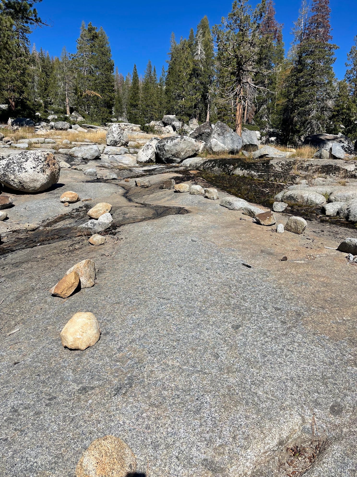
Rock-lined Paths
Sometimes rocks are lined up on the sides of trails. This is common on all trails but it’s particularly useful when walking on a slab of granite and there aren’t any other trail indicators.
Unnatural Disruption
Look to see if there is any other type of human disruption in the area. Sometimes this looks like lines carved into the scenery, likely the trail.

Other times it may look like human footprints in sand, gravel or mud.

Other (obvious) signals are guide posts, railings, staircases, or trash.
Navigate Crossroads
At a tricky section or crossroads of trails, firstly, don't panic. Paths often converge 100 ft out, so it may not matter which way is taken. In addition, with GPS, it's easy to get back on the trail even if a wrong turn is made.
To determine the right path, look for trail markers that are common in that area. If there are trail markers associated with multiple paths, choose the one with more official markers associated with it, and if that's not clear, choose the one with more markers associated with it.
Another indicator is if branches or rocks block a trail. If a path is blocked, even by a single branch, it's likely indicating that that trail is either closed or is an uncommon side trail.
Lastly, the right trail is generally the widest of the options. Unsurprisingly, commonly used paths became wider over time. If it's unclear which way is wider, try looking 100 ft ahead of the junction. Looking ahead is also valuable for spotting cairns or other trail markers.
Discuss with Others
Whenever I’m stuck, I always discuss with my group which way we think is the trail. As a group, we can discuss different reasons one option may be better. We either reach a consensus or agree to disagree and take stock again in 5 minutes. Either outcome is effective for eventually finding the trail. I’ve found even when I'm alone, I'll sometimes talk out loud and state why I'm taking one trail over the other to get clarity.
The list above on trail markers isn’t exhaustive but rather is a sample of common markers I’ve seen in California. If you have better pictures or a trail marker I missed, leave a comment below.